Monday, June 16, 2014

One Fleurieu over the Tern's rest: cycle touring south of Adelaide

Yankalilla Bay, Fleurieu Peninsula
From Adelaide the Fleurieu peninsula stretches down to Cape Jervis and Kangaroo Island. From a cycle touring point of view, it looked enticing: off road cycle routes from central Adelaide to the coast and down to McLaren Vale; then a relatively quiet main road through to the ferry terminal at Cape Jervis for the jump to Kangaroo Island.

The morning after getting back from the Melrose road trip, I headed out along the Linear Park, the strip of parkland and cycling/walking tracks along the Torrens river leading out to the coast. This involved heading in the opposite direction to where I wanted to go, but cycle touring isn't necessarily about efficiency, and it looked a better option than navigating the South Adelaide suburbs. Some remarkably Pukeko like wood hens browsed by the river. Near the coast, the river was bordered by fields supporting grazing horses.
Industrial landscaping, Linear Park
Horses grazing, Torrens River
Pelican sculpture, mouth of Torrens River
A couple of pelican sculptures announced the sea, and the start of the coastal trail, and I headed down the beaches to Glenelg. At Marino Rocks I picked up the Coast to Vines Trail, a generally off road rail trail leading thorough to the vineyard centre of McLaren Vale - sort of Adelaide's Martinborough - and on to Willunga. The Coast to Vines was generally easy to follow, except for a central section where motorway construction had created some poorly marked temporary detours. In many places it's following an old railway line, and the country railway stations have been reestablished as shelters along the route.
Coast to Vines trail

Grazing kangaroos near McLaren Vale
It was late enough by the time I approached McLaren Vale to see kangaroo families browsing the farmland in the dusk; but fortunately was able to make a cabin at the campground before it was completely dark. After locating a hose I was finally able to remove the bulk of the Mawson Trail mud, then headed into town for a meal.

Next morning I headed out early, following the final section of the Coast to Vines trail (here re-branded as the Shiraz trail) through to Willunga.
Cyclng through McLaren Vale vineyards

Southern terminus of the Coast to Vines trail
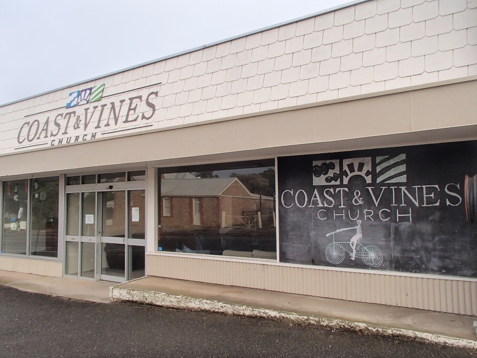
A fine bacon and eggs breakfast and good WiFi delayed progress so it was relatively late morning by the time I got onto the main road heading south. As well as a few well appointed cafes, Willunga has a church apparently dedicated to the trail
The Coast and Vines Church caters to the spiritual needs of cyclists completing the trail
Cafe bacon and eggs catering for cyclists' less spiritual needs, Willunga
Although bearing the title of "Main South Road", the B23 had good shoulders and light traffic, climbing up to skirt the Myponga reservoir before dropping down through the country town of Yankalilla, hitting the coast for a while, then climbing up to Delamere with a view of the Starfish Hill windfarm, and a sunset run down to Cape Jervis and the waiting ferry to Penneshaw.
Myponga Reservoir

Starfish Hill Windfarm at sunset
Folding the Tern and putting it in the baggage van saved me buying a bike ticket. Being mid-week and off season everyone on the boat seemed to know everyone else, and were comparing notes on their trip up to the big smoke of Adelaide.

In Penneshaw a short climb up the hill lead to a heat pump warmed room at Kangaroo Island Backpackers, and a stroll along the main drag to the Penneshaw pub for bangers and mash.

Unfortunately time was running out, and I realised that exploring Kangaroo Island by bike needed at least a week rather than the day I had left; so I settled for a ride along the shore past a curious Greek temple like structure sheltering  a reproduction of a rock carved by French explorers in 1803.
Shelter for rock carved by French explorers, Penneshaw bay
When the road curved inland I parked the bike and headed up Ironstone Hill, site of a farm belonging to an early settler, Harry Bates. Before the arrival  of threshing machinery, Harry processed his grain on a circular threshing platform, now looking like a druidic circle on the summit of the hill.
Threshing circle, Ironstone Hill
Kangaroo Island is relatively pest free, and a haven for wildlife. Out to sea, a couple of dolphin worked their way down the coast, and in the scrub, shy wallabies peered out nervously as I passed. Despite the island's name, I failed to see any kangaroos.
Wallaby, Ironstone Hill track
Next morning I was back on the ferry, and the connecting bus to Adelaide, covering a couple of days cycle touring in a few hours. The Peninsula had turned out to be a satisfying cycle touring area - a good rail trail south from Adelaide, relatively quiet roads in the south, and lots of potential if I manage to make it back to Kangaroo Island - who knows, I might even see a Kangaroo!


Origami ancestor worship on the Mawson trail

As far as I know, I'm not directly related to Sir Douglas Mawson, the Australian Antarctic explorer. However my grandfather, Reverend William Mawson, was a contemporary, and in his own way, an explorer and adventurer. While Douglas was harvesting scientific data in the deep south, William was attempting to harvest Chinese souls for the Presbyterian church, at first among miners on the Otago goldfields, then at a mission station near Canton.
Douglas Mawson (right) and companions at the South Magnetic Pole, 1909
William Mawson (sitting on ground, left) with Chinese miners, Otago Goldfields, 1890s.
The 900 km Mawson Trail is named after Douglas. William's legacy includes the mission station near Canton/Guangzhou, now a hospital where no corporate memory survives of its NZ Presbyterian origins.
Rush hour in Melrose
Melrose is a small rural South Australian town on the edge of the Mt Remarkable National Park that has reinvented itself as a mountain biking mecca, and was the destination of a post Velo-City road trip.
Local enthusiasts have developed a network of mountain bike tracks on the side of the mountain which attracted Simon, Patrick and Graeme. But I decided the Mawson connection was close enough that I'd give the Tern origami bike a workout by following the section of the Mawson trail that ran through the town.
Bike sculpture, central Melrose
Mawson trail marker and typical backroad
Finding the trail was easy - past the bike sculpture in the centre I picked up  the distinctive Mawson Trail markers, and the sealed road soon turned to red gravel. The road climbed steadily to Peach Tree cutting, passing small (I guess, for Australia) farms: mostly sheep and cattle, with the occasional vineyard. One farmhouse received its mail via an ingenious miniature flying fox.
Mail delivery
The route is contiguous with the Heysen walking trail, and at one corner a well rugged up lady in a wheelchair waited by her vehicle for the walking companions she was supporting. After a while the route turned away from the hills on Rosslyn Road - another family coincidence since my sister's name is Roslyn.
Rosslyn Road, Mawson Trail
Although the Mawson Trail website suggests the trail requires a mountain bike, on this section the Tern seemed to roll along the packed gravel roads happily; that is, until the route headed back towards the hills and the Wirrabarra forest on Cutting Road. I'd never really associated the Australian outback with wetness, but a week or so of rain had turned the top 10cm of dirt to a sticky Plasticine like mush. The tyres failed to get purchase on this, and worst still it clogged the wheels and mudguards. Eventually I realised it was easiest to get off and walk on the verge past suspect sections, but even so, the progress was slow.
Mud on the Mawson Trail!
By the time I reached the Wirrabarra forest, with glimpses of kangaroos flitting among the pine trees, it was getting late, so I headed out on White Road to rendezvous with the others on the main road. At one point five large adult kangaroo, camouflaged in grey stubble field, suddenly burst from cover running ahead of me but peeling off over the ridge before I could get my camera out.

A cellphone call established that the others were on their way to pick me up, so I stopped at a water hole and, with the strains of Waltzing Matilda ("...camped by billabong/ Under the shade of collibah tree") running through my head, attempted to get the worst of the mud off the bike before loading it into the pristine interior of the rental car.
Emerging from a waterhole with a (sort of) clean bike [photo courtesy of Patrick Morgan]
A few hours driving and a car wash later we were back in Adelaide and ready to deny having ever allowed dirt roads to have sullied the tyres of the rental car in contravention of the rental agreement.

I'm not sure what the 1800's Mawsons would have made of this brief adventure: probably too tame for Douglas (although post-Antarctica he spent time researching the geology of the Flinders Ranges) and too frivolous for William. But it provided a good chance to explore rural Australia at bike pace: next time I'll try to do it in a drier season!

Monday, June 9, 2014

Stairway to heaven: by gold card to the Paekakariki escarpment


Stairs climbing towards the skyline on the Paekakariki Escarpment.
The 9:15 Kapiti train has lot of grey heads, as it's the first train out of Wellington that qualifies for a Gold Card discount.  This morning the guard doesn't even bother looking at the proffered cards, dispensing free tickets to anyone who meets minimum standards of wrinkliness and greyness. He does however upbraid several seniors for attempting to discretely quaff takeaway flat whites, in flagrant violation of the "no food no drink" ideograms on the Matangi unit's walls.

Over the last couple of years, when heading north from Wellington, I'd noticed a track wending along the high escarpment that towers above the road and rail corridor between Pukerua Bay and Paekakariki. Where did it start, and where did it lead to? A bit of research showed that it was the Paekakariki Escarpment track,  part of the Te Araroha trail, and intended to connect Paekakariki and Pukerua Bay, but currently only completed about half way from the Paekakariki end.

So this morning I'm taking advantage of retirement and my newly acquired Gold Card to head up to the place of the colourful kakariki parrots, and check out the route.

Ames road out of the Paekakariki settlement leads to an ingenious "Ames Spiral", looping across the rail bridge, underneath, and through a planting area of new native shrubs. For a while, the track bobs up and down close to the rail line, as if hesitant to break away from Wellingtons lifeline. Squadrons of tiny larks practise high speed tree hugging manouevres through the bush. At a bridge, I chat to a couple of volunteers armed with weed eaters, about to clear space for some more native plantings. "We're getting some feedback that we need to put in handrails, some people are complaining of vertigo".

After crossing the outlet of a slip prone gully, the track gains courage and starts climbing steeply on a relentless series of stairways. Near the top I pause for a muesli bar. A guy comes the other way " how far to the top?" I ask. "325 meters" he replies. The precision of the reply is explained by the GPS he's clutching, and that he's a geocacher, searching for objects left in wild by other enthusiasts with the coordinates listed on a website.

For the prescribed 325 meters, the track sidles along, with certainly some narrow sections, and long steep slopes leading to the transport corridor 200m  below, but I avoid any vertigo. Soon I'm at the "under construction" signs that indicate the current trail end. It's a heavenly view, the snow of Tapetueranga showing to the south, the bulk of Kapiti out to sea, and the Kapiti coast arcing north into cloud.

Current end of Paekakariki Escarpent trail, looking south to Pukerua
I chat with a couple who have come up for a picnic with a view; he'd grown up in the Aro Valley so we reminised about Aro School and Holloway Road. I hadn't bought a picnic, so I descended the stairway back down to the Perching Parrot for a fine if not heavenly Tex Mex pie, and plenty of time to catch a Gold Card capable train back to Wellington.


Wednesday, May 14, 2014

Alps 2 Ocean: a kiwi cross section

The neat thing about the Alps2Ocean cycle trail is that it's effectively a cross section of the South Island: you start near the divide, and follow a major river, the Waitaki, out to the Pacific Ocean. On the way you pass through high country tussock, 1960s mega power schemes, ancient fossils and rock carvings, dairy conversions, and end up in the Steam Punk Port city of Oamaru.

After a week of mountain biking in Wanaka, the Blokes dropped me at Pukaki to start the ride. Officially the ride starts even closer to the divide, with an $800 chopper ride from the Hermitage across the Tasman river to Braemar Station, but most people start from Pukaki.
Obligatory selfie, looking back up Pukaki to the divide
Cruising the Pukaki lakeshore
The trail bounced around the lakeshore to the Pukaki Dam, where I stopped at the Salmon Shop for a traditional high country salmon sushi lunch. Yes, that's right - lamb no longer rules the McKenzie country.
Salmon sushi, Pukaki dam
After the dam, the trail heads cross country through tussock land to Twizel, where I shared a room with a couple of French lads and their well worn sock collection. Next morning I headed out of town to join the hydro canal leading down from Lake Ohau. 
Salmon farm on hydro canal, local angling for escaped salmon
On the way I passed the salmon farms, big floating cages seething with the fish. On shore, the odd angler cast their lines for escaped salmon.
Moa nest, Ohau
A surprise was stumbling on a late season Moa nest. The Alps2Ocean is of course the only one of the Nga Haerenga/ NZ Cycle Trails where cyclists have a chance of seeing these shy creatures in the wild. During the breeding season (starting 1 April) cyclists are advised to sound their bells frequently to avoid surprising Moa - adults, particularly if accompanying chicks, can be aggressive.

At Ohau the well graded Tarnbrae trail climbs the hillside from Ohau lodge to a 900m high point with great views back up the Hopkins and Dobson, across the lake to Ben Ohau, and south across the tussock to Omarama. Since Ohau Lodge was closed, I took a steeper shortcut up Sawyer's track from the lakeshore, rejoining Alps2Ocean at the Sawyers Creek Bridge. 
Tarnbrae high point - all downhill from here
From the high point, it's a cruisy downhill through the grasslands to Omarama, particularly with a tailwind coming down from the mountains.
Across the grasslands to Omarama
Curious alpine technology: either an incinerator, or an early model robot
From Omarama the Alps2Ocean follows the main road down the Waitaki. This could be busy in the summer holiday season, but the road is fairly quiet in May. For the first time on the trip, I had rain.
Racing the rainbows from Omarama
Off road trails are being developed, unfortunately often just paralleling the road, which doesn't seem much fun, so most of the time I took advantage of the smoother surface on the road.

At Otematata I warmed up with a hot chocolate, then turned off the main road and across Benmore Dam, one of several 1960s mega energy projects in the Waitaki. On the other side the trail follows the almost deserted road around Lake Aviemore, reputedly teeming with thousands of campers in the holiday season.
Autumn colours on the Aviemore Road
Soon the rain stopped and I completed the Aviemore circuit in sunshine.
Good signage on the A2O
My stop that night was the Kurow Pub. Usually I'm an early riser, but I was put to shame by the bridge building gang occupying the hotel. By 5:30am eager workers were clomping up and down the corridor, and by the time I made the breakfast room, I was definitely on the second or third sitting.
Kurow Pub
Hakataramea Motors, Kurow
Dawn shadows south of Kurow
At Duntroon I stopped for coffee from the Van Cafe - the Flying Pig cafe had closed for the season - and got a personal tour of the Fossil Museum, with introductions to the giant penguin and toothy dolphin that had populated this part of Zealandia tens of millions of years ago.
When good dolphins go bad - or at least sabre toothed
The trail turns south of the main road at Duntroon, onto quieter rural roads through the limestone landscape of Elephant Rocks, used for location shooting on the Narnia film, and occasional caves harbouring Maori rock art.
Elephant Rocks
Near Ngapara, I experienced a Hitchhikers Guide/Dr Who moment when confronted by a row of concrete water towers - at least I think they were just water towers.
"Do you think the humans have noticed us, O One Eye?" "No, they're so stupid they don't even know the answer to life the universe and everything"
It was a bit of a shock when the sky started to turn red, and the light faded, with 10 km still to go to the end. I dashed through the Oamaru suburbs on the rail trail, through the botanic gardens, past Steam Punk HQ, and out along the pier to where there was only ocean still to go.
Dusk, and journey's end
Then it was uphill to meet my kind host, Philip of Oamaru Libraries - my professional links haven't quite died - and next morning the bus to Christchurch. 


Are pies square? The Blokes bike Wanaka.

Generally I find air travel pretty reliable, almost as reliable as biking. But in the last month I seem to have had a run of aborted landings. First a Auckland-Wellington flight that turned into a return when the pilot couldn't distinguish a foggy Cook Strait from a foggy runway.  Now we we're into our second go at landing at Queenstown.  The wingtips were brushing the matagauri and spaniard on the mountain slopes as we glided down valley. There was a collective holding of breath as we approached the Remarkables corner, where we'd be exposed to the full southerly cross wind coming up Lake Wakatipu. Would it be another aborted landing? For a second time there was a roar as the pilot applied full throttle and climbed. "Sorry folks, we're going  to Christchurch and waiting for a better weather window". The "weather window" turned out to be a six hour bus ride, so it was late in the evening when Kevin and Bill picked me up at Tarras.
Steve and Anthony take in the sunset at the Wanaka house
The Blokes had borrowed a friends house in Wanaka for a week of mountain biking. We regularly ride on Sunday mornings, and it looked like we could cope with a week together without danger to our health - but little did we know. I'd been delayed by a medical appointment, at which a skeletal survey, blood test and CT scan indicated I was OK "so long as you don't do the sort of mountain biking where you fall off" my specialist said. 

But the real threat appeared when I got to the house - in the kitchen the fridge and every surface seemed to be laden with gourmet (i.e. high calorie, supersaturated fat) foodstuffs. Apparently the food budget had got to the point where the manager of the local supermarket had taken to personally escorting the the group around on their twice daily spending sprees, before slipping off to phone his sharebroker.

Next morning we made some inroads as Bill rustled up bacon and eggs "we could do some salmon steaks as well if you feel hungry..." then headed off to Queenstown, taking the long way, partly since there was still snow on the Cardrona, but mainly so we could identify vineyards to visit on the way back.

The days objective was the mountain bike park accessed by the Queenstown Skyline Gondola. We bought tickets, figured out the loading system, and headed up.
The Blokes at the top of the Gondola - no calories were harmed in the making of this ascent
Hammy's track looked like a good start, graded as easy. Nice flowing lines through the pines taking us out to the back near Ben Lomond, then down for another gondola ride.

Ben Lomond assesses Bill's riding style
How about Vertigo, an intermediate run? This seemed to be a family route - families. that is, of identically Lycra clad parents and kids, some as young as five (the kids, not the parents!) with full suspension rigs, incredible track holding skills, and a complete lack of fear. After a few spills, Bill and I decided not to intrude on their enjoyment, and that Hammy's was so good it could cope with a few more runs, particulary if leavened with a dose of the curiously named Thundergoat.

Around lunchtime we all met up at the top of the Gondola. The stress of riding downhill seemed to have burned off the breakfast, and we felt sure that Russell, waiting to be picked up at the airport, would not want us to picking him up in a calorie depleted state, so we trooped into the cafe. This was the start of the Pies. We all ordered them, and they were delicious, and perfectly healthy if combined with the low calorie tomato sauce.
Pies at the top of the Gondola: Steve attempts to distract Kevin from his supersaturated temptation, while Bill documents the occasion for the coroner
We picked up Russell, and headed back down the wine trail towards Wanaka, purchasing sufficient supplies to ensure that that our resveratrol levels remained healthy.
Bill and Steve consider the health benefits of  Peregrine wines
That night we heard about the Wanaka super pie. Kevin's nephew and his partner came around for dinner - the memories have faded, but perfectly cooked $70/kg merino lamb was involved - "you haven't been to the Golf Club? You've got to try the Lamb Shank Pie!". Apparently the Golf Club serves lamb shank pies that are mouth watering, generously sized, and world famous on Trip Advisor. "The best pies in New Zealand, especially the lamb shank!". You can also play golf there.

So next day we were on a tight schedule - after a light pancake breakfast (with bacon, whipped full cream, bananas, and pears) we'd whip around the Millenium track to Glendu Bay, and back to the Golf Club for the first pie sitting.
Wanaka foreshore
It was a blue bird day, and despite being on a camera diet - I'd been banned from taking my 2kg DSLR on bike trips - there was enough fun to be had photographing the reflections and autumn colours on my compact  Olympus TG-820 that I fell behind the group.
According to Tourism New Zealand, 2,893,564 copies of this image are exported from NZ in an average autumn, leading to an international balance of scenic beauty deficit; fortunately this is reversed 6 months later when New Zealand tourists hit the cherry blossoms of Japan, and the US fall colours.

In fact I fell so far behind that my next meeting with the Blokes was as they retreated from the Millenium track, racing back towards the Golf Course and Pie Nirvana.

Millenium Track to Golf Course and Lamb Shank Pies
I find it difficult to give up a track once I'm started on it, and continued on, stopping occasionally to try and remind myself which of the peaks visible up the Matukituki was the real Mt Aspiring/Tititea
Approaching Glendhu Bay on the Millenium Track; a ridge of bogus Aspirings in the background
The real Aspiring stands out from Glendhu Bay
I returned to Wanaka, and decided that since the Blokes had probably swept the Golf Club clean of pies, I'd content myself with a goat pie from the foreshore bakery. Later on the outlet trail to Deans Bank I caught up with the Blokes and heard the sad tale - the Golf Club had run out of Lamb Shank Pies! However as we spoke the cook was specially preparing a delivery of pies, and that evening we dined on the rotund wonders - and very fine they were too.

Next morning the question arose of whether all this food was exactly healthy. The choice of margarine, naturally, came under the spotlight. Fortunately, after a close reading of the ingredients on the container, and an exhaustive literature search, our medical advisor, Russell, was able to assure us that it was. We returned to our healthy bacon and eggs, and eased up on the nasty statins.
Good news - 90% of Cochrane reviewers eat our margarine
Then we headed off to sample the Luggate pub lunch. The Wanaka trail network offers a round trip: the Newcastle Track, a slightly mountain bike option down the true left, and an easier trail option. the Upper Clutha River Track, up the true right. As usual, I got entranced by the photo opportunities and fell a bit behind.
Clutha from the Newcastle Track
Just as I reached the end, I got an urgent call from the pub - a busload of tourists were about to descend, and we had to get our order in quickly! A random pick from the menu, and  sufficient battered cod was ordered to prevent starvation on the way back.

We made our way back along the terraces of Upper Clutha River Track, with Russell keeping an anglers eye out for trout in the river below.

Kevin, Steve and Russell check out the Clutha
Kevin shreds the Upper Clutha trail..
...but couldn't resist the lure of a permanent hammock
 The last night and morning were devoted to tidying the house, and using up the last of the supplies ("hey guys, I've just found a bunch of salmon steaks in the bottom of the fridge"). What healthy delicacies we couldn't consume, we distributed about Kevin's relatives, playing Blokes Bountiful before heading north over the Lindis. I, as a "Gentleman of Leisure", as my business card says, didn't have a Monday deadline luring me back to Wellington. I swapped my knobblies for road tyres, and got the Blokes to drop me at the Pukaki start of the Alps2Ocean trail to the sea.
Retired person's business card, courtesy of Martin
But that's the next blog...