Wednesday, May 14, 2014

Alps 2 Ocean: a kiwi cross section

The neat thing about the Alps2Ocean cycle trail is that it's effectively a cross section of the South Island: you start near the divide, and follow a major river, the Waitaki, out to the Pacific Ocean. On the way you pass through high country tussock, 1960s mega power schemes, ancient fossils and rock carvings, dairy conversions, and end up in the Steam Punk Port city of Oamaru.

After a week of mountain biking in Wanaka, the Blokes dropped me at Pukaki to start the ride. Officially the ride starts even closer to the divide, with an $800 chopper ride from the Hermitage across the Tasman river to Braemar Station, but most people start from Pukaki.
Obligatory selfie, looking back up Pukaki to the divide
Cruising the Pukaki lakeshore
The trail bounced around the lakeshore to the Pukaki Dam, where I stopped at the Salmon Shop for a traditional high country salmon sushi lunch. Yes, that's right - lamb no longer rules the McKenzie country.
Salmon sushi, Pukaki dam
After the dam, the trail heads cross country through tussock land to Twizel, where I shared a room with a couple of French lads and their well worn sock collection. Next morning I headed out of town to join the hydro canal leading down from Lake Ohau. 
Salmon farm on hydro canal, local angling for escaped salmon
On the way I passed the salmon farms, big floating cages seething with the fish. On shore, the odd angler cast their lines for escaped salmon.
Moa nest, Ohau
A surprise was stumbling on a late season Moa nest. The Alps2Ocean is of course the only one of the Nga Haerenga/ NZ Cycle Trails where cyclists have a chance of seeing these shy creatures in the wild. During the breeding season (starting 1 April) cyclists are advised to sound their bells frequently to avoid surprising Moa - adults, particularly if accompanying chicks, can be aggressive.

At Ohau the well graded Tarnbrae trail climbs the hillside from Ohau lodge to a 900m high point with great views back up the Hopkins and Dobson, across the lake to Ben Ohau, and south across the tussock to Omarama. Since Ohau Lodge was closed, I took a steeper shortcut up Sawyer's track from the lakeshore, rejoining Alps2Ocean at the Sawyers Creek Bridge. 
Tarnbrae high point - all downhill from here
From the high point, it's a cruisy downhill through the grasslands to Omarama, particularly with a tailwind coming down from the mountains.
Across the grasslands to Omarama
Curious alpine technology: either an incinerator, or an early model robot
From Omarama the Alps2Ocean follows the main road down the Waitaki. This could be busy in the summer holiday season, but the road is fairly quiet in May. For the first time on the trip, I had rain.
Racing the rainbows from Omarama
Off road trails are being developed, unfortunately often just paralleling the road, which doesn't seem much fun, so most of the time I took advantage of the smoother surface on the road.

At Otematata I warmed up with a hot chocolate, then turned off the main road and across Benmore Dam, one of several 1960s mega energy projects in the Waitaki. On the other side the trail follows the almost deserted road around Lake Aviemore, reputedly teeming with thousands of campers in the holiday season.
Autumn colours on the Aviemore Road
Soon the rain stopped and I completed the Aviemore circuit in sunshine.
Good signage on the A2O
My stop that night was the Kurow Pub. Usually I'm an early riser, but I was put to shame by the bridge building gang occupying the hotel. By 5:30am eager workers were clomping up and down the corridor, and by the time I made the breakfast room, I was definitely on the second or third sitting.
Kurow Pub
Hakataramea Motors, Kurow
Dawn shadows south of Kurow
At Duntroon I stopped for coffee from the Van Cafe - the Flying Pig cafe had closed for the season - and got a personal tour of the Fossil Museum, with introductions to the giant penguin and toothy dolphin that had populated this part of Zealandia tens of millions of years ago.
When good dolphins go bad - or at least sabre toothed
The trail turns south of the main road at Duntroon, onto quieter rural roads through the limestone landscape of Elephant Rocks, used for location shooting on the Narnia film, and occasional caves harbouring Maori rock art.
Elephant Rocks
Near Ngapara, I experienced a Hitchhikers Guide/Dr Who moment when confronted by a row of concrete water towers - at least I think they were just water towers.
"Do you think the humans have noticed us, O One Eye?" "No, they're so stupid they don't even know the answer to life the universe and everything"
It was a bit of a shock when the sky started to turn red, and the light faded, with 10 km still to go to the end. I dashed through the Oamaru suburbs on the rail trail, through the botanic gardens, past Steam Punk HQ, and out along the pier to where there was only ocean still to go.
Dusk, and journey's end
Then it was uphill to meet my kind host, Philip of Oamaru Libraries - my professional links haven't quite died - and next morning the bus to Christchurch. 


Are pies square? The Blokes bike Wanaka.

Generally I find air travel pretty reliable, almost as reliable as biking. But in the last month I seem to have had a run of aborted landings. First a Auckland-Wellington flight that turned into a return when the pilot couldn't distinguish a foggy Cook Strait from a foggy runway.  Now we we're into our second go at landing at Queenstown.  The wingtips were brushing the matagauri and spaniard on the mountain slopes as we glided down valley. There was a collective holding of breath as we approached the Remarkables corner, where we'd be exposed to the full southerly cross wind coming up Lake Wakatipu. Would it be another aborted landing? For a second time there was a roar as the pilot applied full throttle and climbed. "Sorry folks, we're going  to Christchurch and waiting for a better weather window". The "weather window" turned out to be a six hour bus ride, so it was late in the evening when Kevin and Bill picked me up at Tarras.
Steve and Anthony take in the sunset at the Wanaka house
The Blokes had borrowed a friends house in Wanaka for a week of mountain biking. We regularly ride on Sunday mornings, and it looked like we could cope with a week together without danger to our health - but little did we know. I'd been delayed by a medical appointment, at which a skeletal survey, blood test and CT scan indicated I was OK "so long as you don't do the sort of mountain biking where you fall off" my specialist said. 

But the real threat appeared when I got to the house - in the kitchen the fridge and every surface seemed to be laden with gourmet (i.e. high calorie, supersaturated fat) foodstuffs. Apparently the food budget had got to the point where the manager of the local supermarket had taken to personally escorting the the group around on their twice daily spending sprees, before slipping off to phone his sharebroker.

Next morning we made some inroads as Bill rustled up bacon and eggs "we could do some salmon steaks as well if you feel hungry..." then headed off to Queenstown, taking the long way, partly since there was still snow on the Cardrona, but mainly so we could identify vineyards to visit on the way back.

The days objective was the mountain bike park accessed by the Queenstown Skyline Gondola. We bought tickets, figured out the loading system, and headed up.
The Blokes at the top of the Gondola - no calories were harmed in the making of this ascent
Hammy's track looked like a good start, graded as easy. Nice flowing lines through the pines taking us out to the back near Ben Lomond, then down for another gondola ride.

Ben Lomond assesses Bill's riding style
How about Vertigo, an intermediate run? This seemed to be a family route - families. that is, of identically Lycra clad parents and kids, some as young as five (the kids, not the parents!) with full suspension rigs, incredible track holding skills, and a complete lack of fear. After a few spills, Bill and I decided not to intrude on their enjoyment, and that Hammy's was so good it could cope with a few more runs, particulary if leavened with a dose of the curiously named Thundergoat.

Around lunchtime we all met up at the top of the Gondola. The stress of riding downhill seemed to have burned off the breakfast, and we felt sure that Russell, waiting to be picked up at the airport, would not want us to picking him up in a calorie depleted state, so we trooped into the cafe. This was the start of the Pies. We all ordered them, and they were delicious, and perfectly healthy if combined with the low calorie tomato sauce.
Pies at the top of the Gondola: Steve attempts to distract Kevin from his supersaturated temptation, while Bill documents the occasion for the coroner
We picked up Russell, and headed back down the wine trail towards Wanaka, purchasing sufficient supplies to ensure that that our resveratrol levels remained healthy.
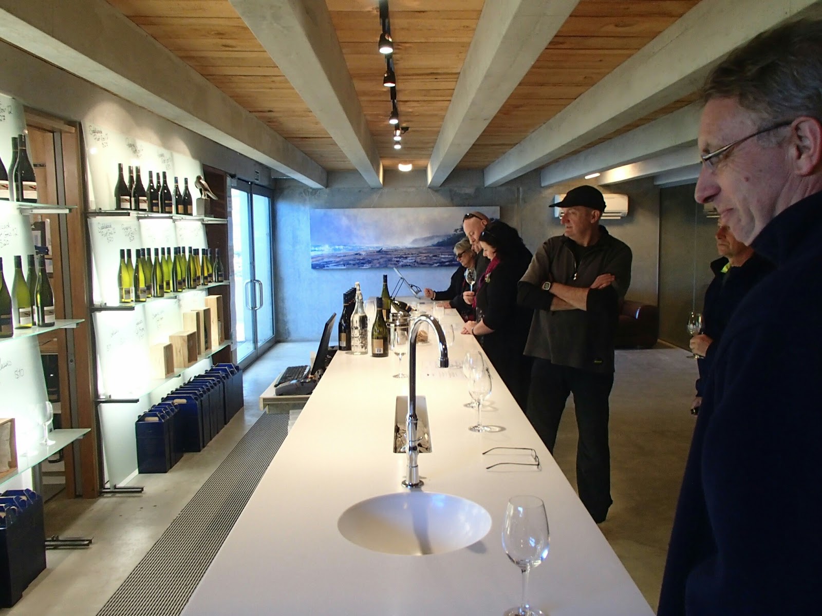
Bill and Steve consider the health benefits of  Peregrine wines
That night we heard about the Wanaka super pie. Kevin's nephew and his partner came around for dinner - the memories have faded, but perfectly cooked $70/kg merino lamb was involved - "you haven't been to the Golf Club? You've got to try the Lamb Shank Pie!". Apparently the Golf Club serves lamb shank pies that are mouth watering, generously sized, and world famous on Trip Advisor. "The best pies in New Zealand, especially the lamb shank!". You can also play golf there.

So next day we were on a tight schedule - after a light pancake breakfast (with bacon, whipped full cream, bananas, and pears) we'd whip around the Millenium track to Glendu Bay, and back to the Golf Club for the first pie sitting.
Wanaka foreshore
It was a blue bird day, and despite being on a camera diet - I'd been banned from taking my 2kg DSLR on bike trips - there was enough fun to be had photographing the reflections and autumn colours on my compact  Olympus TG-820 that I fell behind the group.
According to Tourism New Zealand, 2,893,564 copies of this image are exported from NZ in an average autumn, leading to an international balance of scenic beauty deficit; fortunately this is reversed 6 months later when New Zealand tourists hit the cherry blossoms of Japan, and the US fall colours.

In fact I fell so far behind that my next meeting with the Blokes was as they retreated from the Millenium track, racing back towards the Golf Course and Pie Nirvana.

Millenium Track to Golf Course and Lamb Shank Pies
I find it difficult to give up a track once I'm started on it, and continued on, stopping occasionally to try and remind myself which of the peaks visible up the Matukituki was the real Mt Aspiring/Tititea
Approaching Glendhu Bay on the Millenium Track; a ridge of bogus Aspirings in the background
The real Aspiring stands out from Glendhu Bay
I returned to Wanaka, and decided that since the Blokes had probably swept the Golf Club clean of pies, I'd content myself with a goat pie from the foreshore bakery. Later on the outlet trail to Deans Bank I caught up with the Blokes and heard the sad tale - the Golf Club had run out of Lamb Shank Pies! However as we spoke the cook was specially preparing a delivery of pies, and that evening we dined on the rotund wonders - and very fine they were too.

Next morning the question arose of whether all this food was exactly healthy. The choice of margarine, naturally, came under the spotlight. Fortunately, after a close reading of the ingredients on the container, and an exhaustive literature search, our medical advisor, Russell, was able to assure us that it was. We returned to our healthy bacon and eggs, and eased up on the nasty statins.
Good news - 90% of Cochrane reviewers eat our margarine
Then we headed off to sample the Luggate pub lunch. The Wanaka trail network offers a round trip: the Newcastle Track, a slightly mountain bike option down the true left, and an easier trail option. the Upper Clutha River Track, up the true right. As usual, I got entranced by the photo opportunities and fell a bit behind.
Clutha from the Newcastle Track
Just as I reached the end, I got an urgent call from the pub - a busload of tourists were about to descend, and we had to get our order in quickly! A random pick from the menu, and  sufficient battered cod was ordered to prevent starvation on the way back.

We made our way back along the terraces of Upper Clutha River Track, with Russell keeping an anglers eye out for trout in the river below.

Kevin, Steve and Russell check out the Clutha
Kevin shreds the Upper Clutha trail..
...but couldn't resist the lure of a permanent hammock
 The last night and morning were devoted to tidying the house, and using up the last of the supplies ("hey guys, I've just found a bunch of salmon steaks in the bottom of the fridge"). What healthy delicacies we couldn't consume, we distributed about Kevin's relatives, playing Blokes Bountiful before heading north over the Lindis. I, as a "Gentleman of Leisure", as my business card says, didn't have a Monday deadline luring me back to Wellington. I swapped my knobblies for road tyres, and got the Blokes to drop me at the Pukaki start of the Alps2Ocean trail to the sea.
Retired person's business card, courtesy of Martin
But that's the next blog...


Sunday, April 13, 2014

Maunga 2 Maunga: memories of the Forgotten World Highway

After the CANDO meeting, I needed to head north to Auckland. Yes, I could have got a bus, or flown. But flying creates excessive carbon emmissions, and trains are more pleasant than buses to travel on. Problem was how to get to the train. The Forgotten World Highway from Stratford to Taumaranui offers a good cycle touring route. I got offered a lift as far as Stratford, and figured I could face biking from Taumaranui to National Park. Despite the lines of Peter Cape's "Taumaranui on the Main Trunk Line" being engrained into the national consciousness, the tourist oriented Northern Explorer train no longer stops there.

This was  a rerun (in reverse) of a trip we did back in the early 1980s; cycle touring then was rare enough to make the local media.
Daylight saving had just kicked in, so when Graeme dropped me in Stratford about 2:30pm, I was conscious of the need to get going to reach the borders of the Whangamona republic before dark; a call to home reinforced that "You've only got three hours of daylight - you'd better get moving".

Fortunately a westerly tail wind sped me across the flat bits to Douglas.  The Nga Haerenga version of the Forgotten World Highway avoids this potentially boring section by heading in from Waitara; but I didn't have time for that variation.
Model students at Douglas School
Mt Taranaki receded gradually; of course I was also roughly following the route that traditionally the maunga followed when booted out of the central plateau by Tongariro, usurping his place as the husband of Ruapehu.
Taranaki selfie
I made it to the top of Whangamomona Saddle before sunset; strapped on lights for the descent, and was knocking on the door of Richard, the affable guardian of the Whangamona Domain Campground before it was truly pitch dark. "Sure - a cabin is 20 bucks - old ministry of works hut if that's OK". For one night, it was. Richard is keen on developing the campground - a range of exercise machines decorate the entrance for the benefit of campers.

I headed up the road to the Whangamomona Hotel for a beer and a plate of venison sausages. The hotel seemed to have retained it's country pub charm, despite a change of ownership; the previous management had created an interesting ambience by using Fawlty Towers videos as a customer relations training tool.

Horses meet folder, Whangamomona
Dawn in Whangamomona is always misty, which isn't a problem at bicycle speed when you meet a herd of sheep, or a group of horses.

Traffic gives way to sheep, Whangamomona
Soon the cloud, and my altitude, lifted, as I climbed to Tahora Saddle, where a small campground/ bed & breakfast exists on an unlikely outcrop; to save the final climb to the accomodation, the letterbox is a scale model.
Mist clearing on the way to Tahora
Letterbox, Tahora Saddle
The heart of the Forgotten World Highway is the Moki Tunnel (aka the "Hobbit Hole"); carved through the soft papa hill in 1936, then upgraded for triple decker stock trucks in 1989 by having the floor lowered.
Moki Tunnel
The road then dropped down to the Tangarakau Gorge - the 12 km of unsealed road left on the route. The lack of traffic, and the atmosphere of the bush clad hills, more than makes up for the gravel.
Tangarakau Gorge
The 90 km from Whangamomona to Taumaranui was more of a challenge than distances like that used to be; for the first time I walked the Tern up a hill at Aukopae, and by the time I got to Taumaranui I was composing letters to John Key suggesting that the town be moved 20km closer to Whangamona in the interest of the Nga Haerenga cycle trails. When I was back in cellphone cover I was fielding anxious calls from home about my whereabouts. I felt a bit better about the time I'd taken when a fellow cyclist at the Taumaranui Hotel admitted that he hadn't made it all the way the previous day, stopping 14 km from Taumaranui.

The next day I headed south to National Park and the mis-behaving maunga: the beautiful Ruapehu and the usurper Tongariro were both shrouded in cloud. On the way, a scrap wood dinosaur offered an excuse to stop before tackling the Raurimu hill.
Dinosaur, Raurimu
Journey's end: Ruapehu acting shy
But the National Park station cafe did a fine curry pie, and then it was a relaxing afternoon on the train, watching the North Island go by till we reached Britomart. 


Baxter, and the five minute rule: a Whanganui ride


Matukituki Valley from Cascade Saddle, 1968
1968. I'd been tramping up the Matukituki Valley, and being young and impressionable had carried a book of poems that included James K Baxter's Poem in the Matukituki Valley. I was hitching south of Dunedin when a blue VW puttered to a stop. The elf like driver beckoned me in. As we got going he introduced himself. "James - James Baxter". "Wow- I've just been in the Matukituki, and was reading your poem..." To be honest, I can't remember much about our conversation - I was rather awestruck by being in the presence of a major NZ literary figure; James K had finished a year at Otago University as the Burns Fellow, but I think he reminisced about the weeks he'd spent with a National Film Unit crew and some NZ climbers, making a documentary about climbing Aspiring. After he dropped me off at the Octagon, our paths, as they say, diverged; James K went on to convert to Catholicism, and founded a commune at Jerusalem on the Whanganui river. I did library and bike stuff.

2014. The annual CANDO meeting of cycle advocates traditionally starts with a bike ride, and this year a group of us started in Raetihi to ride down the Whanganui river.
Don rides down to Pipiriki
The first half was a largely gentle winding descent to Pipiriki, the traditional haul-out for Whanganui canoe trips. By the time we got there I was starting to think about how long it had been since lunch, and that we'd probably missed cafe opening hours, even if Pipiriki ran to a cafe which it hadn't on my last visit.
Patrick at Pipiriki
On the final run towards the landing, I spotted an uphill driveway with a sign advertising ice creams; a split second decision saw me converting momentum into climb, and riding into what turned out to be the old school playground, now the campground. Several of my companions had already checked out the camp shop, converted from a classroom. Sure enough, there were still some ice cream pottles in the freezer, I bought one and went to sit outside on one of the playground benches. The chocolate creaminess was mined with a small plastic spoon from under the lid; and life seemed good. But then disaster - a slip of the plastic spoon, and a substantial chunk of ice cream took flight, and descended onto the concrete. I thought about the 5 second rule: that any food that has laid on a floor for less than 5 seconds is probably OK to eat. 4 seconds. Nonsense, of course - once the food has contacted an insanitary surface such as a school playground, it's polluted and shouldn't be consumed. 3 seconds. "But there's just been some research that confirms the 5 second rule" - this from the delectable chocolate, lying enticingly on the concrete. 2 seconds "seems a pity to waste me" 1 second "and missing out on my calories could lead to an unhealthy dose of bonk before you get to Jerusalem". I quickly scooped up the errant ice cream, popped it in my mouth, and ignored the occasional gritty remnant of it's 4.99 second stay on the ground.

The last part of the afternoon was a pleasant cruise down the newly sealed Whanganui river road to Jerusalem, enjoying the autumn colours and river views.
Gottfried and Lynneke cruise the autumn colours
Bridge across sidestream
Pilgrim Lynneke enters Jerusalem

At Jerusalem we stayed at the convent, choosing beds with floral covers under ubiquitous crosses in what must have been the novices dormitories. We whipped up carnivorous and vegetarian pasta options so we'd be carbo loaded for the following days run to Whanganui, finishing up with Lynneke's fine vegan crumble.
Jerusalem accommodation
Dinner at Jerusalem
Next morning I explored the area - sounds of Pasifika music led me to the garden where Sister Christina was listening to the sounds of her Samoan homeland on Access Radio; the few nuns now at the convent occupy a comfortable Lockwood rather than the old convent.
Sister Christina
Leaving Jerusalem, we stopped by the bridge where a young dog and his mother were waiting. Suddenly there was the roar of a quad bike and a yell "Get out of the way, Fritz!". The pup scooted to the side as the Quad bike lead a herd of cattle over the bridge, driven from behind by a couple of cattle dogs, the working part of Fritz's whanau.
Gottfried waits with Fritz and his mum, Jerusalem
Cattle moving, Jerusalem
Cattle beast thinks about the "share the road" message
Once the road was clear, we headed off down the valley. At this point, the ice cream conversation started again. "You know how I said research proved that the 5 second rule works? Well you of all people should know that you shouldn't believe everything you read on the Internet. I'm afraid it's time to go". And so the trip down the river for me was punctuated with trips into the bush, and the 24 hour starve that usually deals to gastro problems.
River Queen at Matahiwi
Still, it was a lovely ride. The river gently flowed past bush clad cliffs and the small communities. At Matahiwi  another schoolhouse has been  turned into a cafe and gallery, with the "River Queen" from Vincent Ward's movie sitting out front.
Whanganui River cliffs
Later the road climbed up the side of the valley, and dropped over to Upukongaro, where I risked a ginger ale at the pub, and listened to flouro coated forestry workers, their conversation punctuated by an F word, neither flouro or forest, relaxing after their day in one of NZs most dangerous industries. .
Looking back up Whanganui River from saddle
The main group had headed on into Whanganui, but Max kept me company through to the Whanganui rail bridge, where the statistically likely puncture had occurred.
How many cycle advocates does it take to mend a puncture...?
A steep climb up Virginia Road got me to the Quaker Settlement, and a couple of days of discussion of cycle advocacy.

And James K? When I'd talked to Sister Christina at Jerusalem, she'd pointed out the gate and path through the scrub that lead up to the house where James K had established his commune. In front was his grave, looking out across the bush to the church. A long way from the "the altar cloth of snow/ On deathly summits laid" that he spoke of in Poem in the Matukituki Valley; but a good place for him to have found peace.
James K Baxter's grave, Jerusalem