Wednesday, November 5, 2014

The Electric Cycletouring Acid Test

Heading down the Dovedale Valley, snowcovered Mt Arthur behind
Having acquired an eBike, I naturally wondered how it would cope with cycle touring? Would the battery last for a days riding? How easy would it be to charge the battery overnight?

Attending the 2WalkAndCycle conference in Nelson gave me the opportunity to find out. I hatched a plan to ride to Nelson, then join one of CANs post conference rides around the Great Taste Trail.

Having fully charged the eBike's battery, Marg (on Lucie, her trusty Tern folder) and I headed down to the BlueBridge terminal, to meet Russell, grappling with the long load of an A0 poster for his conference presentation. After an uneventful cruise, wandering the decks and breathing the unique mix of Cook Strait salt air and livestock truck odours, we emerged from the bowels of the Santa Regina and headed off along Queen Charlotte drive.
Russell's long load on the Queen Charlotte Drive
The eBike buzzed up the hills confidently and we cruised up the sound to Grove, which seems to be the cute letterbox capital of Aotearoa.

A stiff westerly had got up by the time we tackled the flats across Linkwater, so the eBike went in front allowing Marg and Russell to draft behind, though Marg found it a challenge drafting with the Tern's small wheels, and eventually headed out in front. We made our motel in Havelock in plenty of time for a post ride beer, minor bike adjustments, and dinner at the Mussel Pot.
Russell and friend, Rai Valley
The next day was potentially a test for the eBike - 74km, with two biggish climbs. The last thing I wanted was to be stuck between the Rai Saddle and the Whangamoa Saddle with a flat battery. But in fact the day went smoothly, with the eBike making it happily through the bush clad hills. We'd been a bit apprehensive about the Labour Day traffic, but heading west the road has adequate shoulders and the vehicles were generally following road code guidelines for passing distances. I did notice however that heading east, the shoulders are rather less generous, something to bear in mind when planning a cycle tour.

We stopped at Hira for a late lunch, the resident cat only too happy to help us with our chicken sandwiches. Then on to Nelson, where we picked up the Atawhai trail into town - Russell to the conference motel, Marg and me to catch up with old friends Mike and Patsy.

Cycling conferences are a great chance to recharge one's advocacy batteries, so the eBike got a bit of a rest while we debated mandatory passing distances, shared paths etc. A nice feature of this conference was the breakfast sessions, where early risers could join keynote speakers at a local cafe. One was at Lambrettas, which attracted me since a Lambretta scooter had been part of my two wheel evolution.
Lambretta meets eBike at Lambrettas
After the conference, I met up with the two day cycling group, and Ian kindly guided us out on the bike paths to Wakefield and Get Real Backpackers.
Coastal cycle path to Richmond
Trevor, our host, took us for a tour up the back fields, accompanied by Angel, a sprightly two year old dog keen to chase thrown branches.
Angel plots to stow away on Patrick's bike
The next day we headed back into Wakefield for a bakery breakfast which powered us up for the Dovedale saddle. The eBike coped with the climb along winding gravel roads through forestry land, then it was a fine run down through the Dovedale valley, which had several of us declaring it the "finest cycle touring in NZ" .

We stopped for a rest at the Dovedale Cricket pavillion. In the nearby churchyard was a memorial to Edward Eban, who died of injuries sustained on the Upper Moutere cricket field in 1908.

On we rolled down to Woodstock, passing a Landrover graveyard, and across the Motueka River to the quiet West Bank. Around lunch time I noticed a group of road workers in fluoro sitting in the shade of a tree by their truck. It was only after the calls and yahoos followed me down the road that I realised I'd biked past my companions having lunch. Time for another visit to the optometrist! At Ngatimoti we crossed back to search for the rumoured cafe, but it was closed, and we contented ourselves with a chat with a friendly member of the Ngatimoti Bowling club. At Riwaka the trail took a circuitous route to end up at the new cycleway clipped on to the Motueka River Bridge, and we finished the day's exertions with fruit icecreams at Toad Hall. The four day tour had also arrived, so we dined together at the Sprig and Fern.
Ice creams at Toad Hall
Helping with inflation issues on a canine carrier, Toad Hall
Sunday was the last day, and I decided to test the range of the eBike by heading up to Kaiteriteri before going along the coast back to Nelson. It was a good choice - following boardwalks and stopbanks along the shore then and easy single track route through the Kaiteriteri mountain bike park to a coffee and slice at a beach side cafe. Kaiteriteri seemed quiet, no doubt resting up for the boxing day invasion.
Coastal boardwalk to Kaiteriteri
Back in Motueka Patrick and I formed the rear guard of the two day excursion, and headed east. At Riverside Cafe, we were distracted by "Look, it's Patrick" from a table of Wellingtonians, but decided to press on in search of the perfect sandwich.
Leaving Riverside Community
About here the trail designers must have decided that cyclists were in need of a variation from flat gradients, and took us on firebreaks to a high point at the top of Harley Rd. The eBike coped fine, but I did wonder what the reaction is from those expecting an Otago Rail Trail topography.
Summit of the Harley Rd deviation
At Tasman I discovered a fine sandwich (eschewing the attractive looking "cyclists slice"), and Patrick discovered a puncture. After several immersions of the tube in a water bath kindly provided by the storekeeper, we were on our way, and the countdown to the 4pm sailing of the Mapua Ferry began, Initially the refrain was "lots of time to get there by 4pm" but as the wind rose, and the trail  took increasingly less direct routes,  I cranked up the eBike to maximum power settings, and we arrived on the jetty at exactly 4pm - to see the ferry part way across the channel to Rabbit Island. It turned out the schedule was merely a guide, and on his return the skipper agreed to take us across, despite the challenge of maneuvering the ferry through the wind driven waves. Punters wanting a return trip were out of luck, though - he wasn't certain he'd be able to make another trip. At Rabbit Island we quickly ran the bikes down the gangplank and up the soft sand.
Alastair doing a McArthur imitation on Rabbit Island
Crosswinds plagued our progress along Rabbit Island, and we were glad to head inland and across the causeway to pick up the final section of the trail into Nelson. I was made welcome again by Mike and Patsy, just returned from a steam boat excursion on Lake Rotoroa, and the next day took the bus and ferry back to Wellington.

So is cycle touring on an eBike feasible? Certainly. Admittedly, I'd kept the power control on the most economical setting, and just used the hand control for a power boost on hills. But the last day was over 80 km, and the battery was still showing 3/4 full (though I suspect the drop from 3/4 to empty is more rapid than from full to 3/4). I didn't have problems with charging, though it helped that I'd bought a double plug, and that the eBike's battery is removable.

So even now, the next electric cycle tour is being plotted... watch this space.

[More photos of the trip on Google +]

Thursday, October 23, 2014

Go north, old man?

Aquatic life off Poor Knights Islands
When we decided on a road trip around Northland, we discovered that a surprising number of our contemporaries were established in the winterless north: Like the snowbirds of the US, who abandon Chicago for Florida, Kiwi baby boomers head over the Auckland harbour bridge and don't look back. Mind you, we discovered that Auckland's urban sprawl is hot on their heels, as tastefully landscaped housing developments spread north across the farmland.

First stop was an old school friend of Marg's, settled in a cliff top house on the Whangaparaoa peninsula. Helen and Jim had a great view north, fishing and swimming from the beach below their house, but Jim's road cycling group are finding that their morning rides are becoming more less enjoyable as they coincide with the commuter congestion.

We went on to visit Bob and Helen, who have for years pursued a nomadic lifestyle (perhaps due to Bob's former existence as a sea captain) and have gone from a comfortable Remuera town house to pioneering a lifestyle block near Warkworth. We got a tour of the house site - well chosen in the shelter of a hill  to the north, but not so high as to block the winter sun, covenanted block of native forest blocking the prevailing westerlies, and a restful view south up a rural valley.

We walked Warkworth, a transport nexus in the days of coastal scows, saw the Jane Gifford heading off with a cargo of tourists, and admired a charming steam launch moored on the quay.
On to Whangarei, to catch up with Brian and Sue. Brian, although an engineer by profession, is a serial lifestyle blocker: set him down in any city, and within weeks he'll have acquired 10 acres of land, 30 head of sheep and a shed full of agricultural equipment. The Whangarei estate was impressive - a relationship with a local digger driver with access to large rocks had resulted in a small lake with islands, and the cantilever framed shed could have been used for country dances in the days when that was fashionable. They were pleased with the move north - Sue felt the crux had been a business trip to the balmy north "I got back to Wellington - and it was SNOWING".

We had arranged a trip out to Poor Knights islands with Dive! Tutukaka. Poor Knights, about an hours boat run off the coast, is a cluster of pinnacles, with steep rock faces dropping straight into the sea, and currents connected with the Australian coast that result in occasional geographically confused tropical fish enhancing the fishlife of the marine reserve, making it a mecca for divers and snorkelers
Waiting for the boat to depart, we discovered we had a special passenger - a Mollymawk being returned to sea after rehabilitation. The massive bird was housed in a comfortable cardboard box, but was let out for a stretch on the wharf, to the delight of passers by.

Once we'd arrived off the Poor Knights, in a sheltered spot by Rikoriko cave, the Mollymawk went on its way to a clicking of iPhones, and we donned heavy duty hoods, vests and wetsuits (OK, the warmth of the water is relative - it was still spring) and splashed in to a watery world of clouds of fish. The buoyancy of the wetsuits meant we couldn't dive, but the views as we explored along the edge of the cliffs was amazing. You could explore up narrow channels into the rock face, turning back to see the clouds of fish silhouetted around the entrance.

Over lunch back on the boat, the guides told us of the history of the island, how the resident iwi enjoyed a porcine monopoly after Captain Cook had dropped off some of his eponymous pigs, but lost both pigs and lives in a retribution raid.

Then we went back in for another spell of snorkelling, and I lost track of time, entranced by sights such as a green sea snake wending it's way through the seaweed, and was the last back on board the boat before running back to Tutukaka.

We'd ran out of friends to visit, but Paihia had plenty of motel vacancy signs, and the Outrigger seemed as good a choice as any.

One reason for visiting the Bay of Islands was the Twin Coast Cycle Trail - one of the Nga Haerenga cycle trails. It's not yet complete, and I'd found varying information on how much was open. We decided to start from Opua, where the trail starts in the back of the shipyards, and see what happened. The gravel trail up the Kawakawa inlet was fine as was the weather. The rail lines have been retained  under the gravel, and sometimes emerge to keep cyclists alert. At Taumarere bridge the cycle path clipon had just been completed so we could bike across what is supposedly the longest curved rail bridge in NZ - though I'd have thought Hapuawhenua rail viaduct near Ohakune was longer. On the other side, a group of rail enthusiasts were having smoko in their boxcar that had been shunted through from Kawakawa, and confirmed that the plan was to extend the heritage rail line through to Opua - though it's not clear how this will coexist with the cycle trail.
At Taumarere the cycle trail ceases, and a hilly 3km on the main road took us into Kawakawa, and the next section of the trail through to Moerewa.  Moerewa is definitely Tangata whenua country - no middle class flight from colder climes here. People say "kia ora" because that's how they say hello, not because they want to be bicultural. The United Tribes Confederation flag flew over a veggie patch, and the Marae  with its imposing archways is well maintained.
For the moment the cycle trail finishes here (though secondary roads would provide a good route through to the next completed section at Kaikohe) so we headed back the way we'd come, eating our picnic lunch in the Kawakawa domain while the guys with the ride-on mowers waited patiently for us to finish.

We still had the afternoon, so decided to do the Kaikohe-Okaihau section as a vehicle swap - Marg dropped me at the Kaikohe end, drove around to Okaihau, and we passed in the middle. This section has been established for some time, and follows the route of the Okaihau express, immortalised by 1950s folk singer Peter Cape. There are good informational signs, a tunnel long enough not to be able to see the other end, small mountain bike tracks branching off the main route, and a good view of Lake Omapere, where "The fireman takes the bucket, the driver takes a swim".
Next day we tackled the "Full circle walk", which connects bush and coastal trails with the ferries, enabling a circuit Paihia - Opua - Okiato - Russell. Another brilliantly fine day (though the locals were as surprised at this as we were) as we walked along the beach to Te Haumi Bridge, then took to the bush track sidling and dipping into bach bordered beaches.
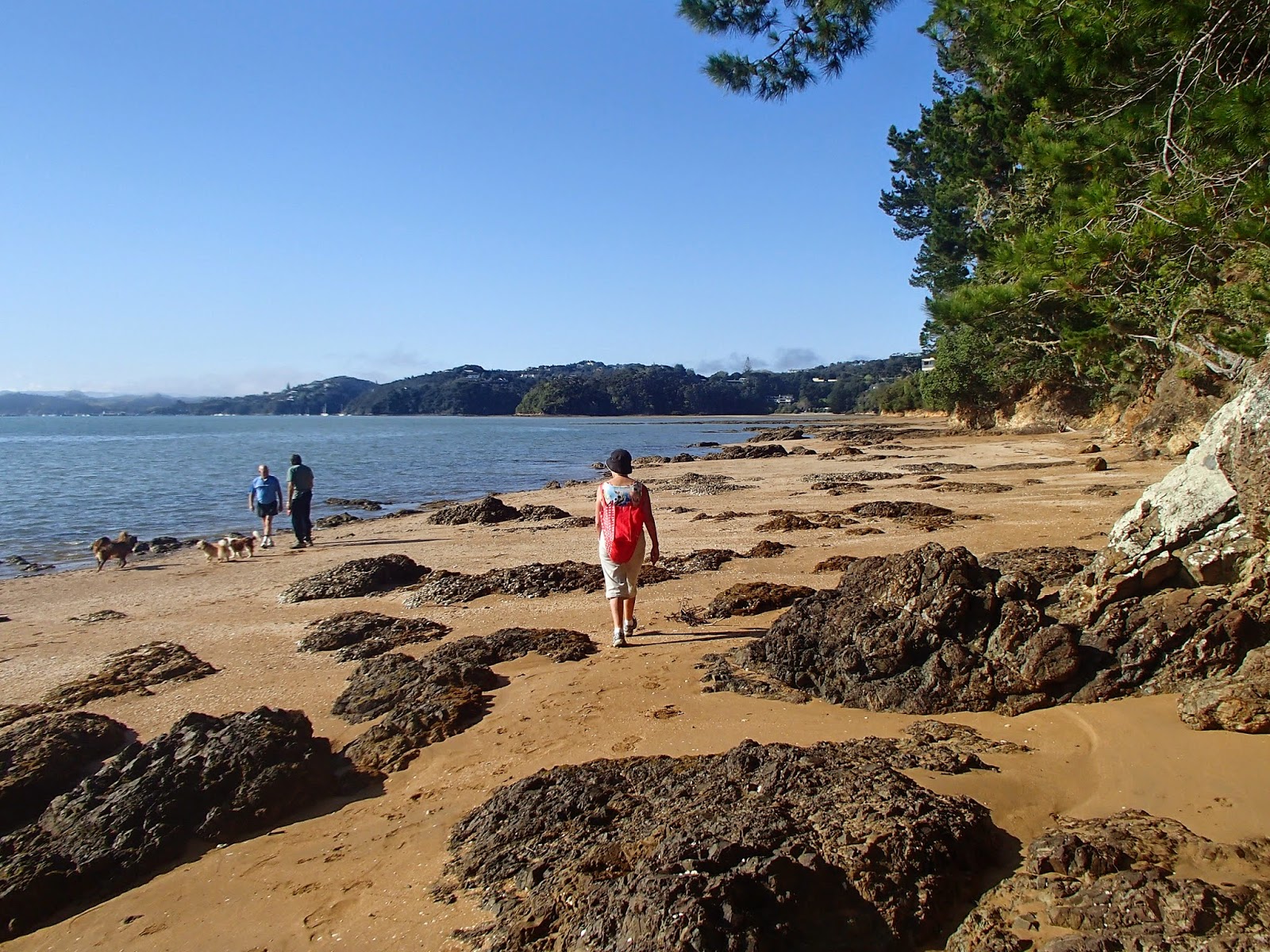
At Veronica Point we climbed up to a solidly constructed viewpoint, then dropped down to the wharf at Opua. With a boat every 10 minutes one can be relaxed about the schedule, and soon we were climbing up the road to the site of NZ's first capital - not a lot to see other than the well that provided the first legislators water - then join the Okiato to Russell walkway. this actually takes about three hours, so to avoid distress the signs simply tell you how long it is for the next section, so it took us a while to realise that it was going to be late lunch in Russell. Fortunately a swim at Pipiroa Bay set us up for the next few hours of up and down walking through attractive Kanuka and Kauri.

We made it to Russell and settled down at a waterfront cafe. Breathless cellphone calls brought the news that the auction of my mothers house in Auckland  confirmed the inflated state of the Auckland property market, and that we could probably afford to splash out on an extra cake and coffee.
I'd also been keen to try kayaking, so next morning Marg consented to join me in a double kayak up the Haruru River, to nose up to the rather grubby water pouring over the falls. Then it was south on toll road, and a flight back to Wellington for me.

Had I been tempted by moving to the winterless north? When I got back to Wellington I collected the folding bike, put it on a luggage trolley, found a taxi and loaded the bike in. When I turned around, the luggage trolley was being blown by the gale towards Cook Strait. It was good to be back to a place with real weather.

More photos of the trip on Flickr...

Thursday, August 7, 2014

Coasting with the Tern

It was the sort of day that I'd anticipated for my retirement - not a cloud in the sky, no commitments, nothing to stop me going on an expedition. I'd decided to take advantage of the folding bike and my gold card to do a circuit: train to Waterloo, bus to Wainuiomata, ride the coast road to Baring Head, along the coast to Pencarrow and around to Days Bay, then ferry back to Wellington.

Every expedition has a "crux" - a point which if it can't be passed, the expedition fails. Climbing Mt Earnslaw for example, the crux is a gently sloping slab of rock - an easy stroll if it's dry, impossible if ice covered.
Don retreats from Earnslaw after we'd failed to pass the crux slab, 1974
For todays expedition, the crux was a bit more prosaic: the 160 bus to Wainuiomata.Would it take my folding bike? In anticipation, I'd printed out Metlink's bike policy which explicitly allows folding bikes on buses, but drivers have been known to disregard this. So I was a bit nervous waiting at Waterloo Stop C for the 160 to arrive. In the event there was nothing to worry about - "what a cool bike!" was the drivers reaction, I waved my gold card, and in a moment we were roaring up the Wainuiomata Hill faster than I've ever biked it. I was treated to a tour of Wainuiomata back streets, then dropped at the Village to start the coast road.
The great thing about Wellington is how quickly you can be in countryside. A few kilometres down the coast road, it was difficult to believe that I was just down valley from one of Wellington's most populous suburbs - "nappy valley" of the 1950s. The road followed the Wainuiomata River winding across the flats, and horses, sheep and cows populated the lifestyle blocks.
Stables on the Wainuiomata coast road.

A bleat from the roadside posed a ethical dilemma - a kid had its head trapped in the fence. Goats are pest animals, and logically I should have taken the opportunity to remove this one from the live population. But the cuteness factor, the anxious looks of mum back in the scrub, and the remarkably human sounding distress cries overcame my environmentalism, and I bent the wires to release it. I last saw it trotting after mum, heading in the direction of the nearest patch of native forest...
Bridge across Wainuiomata River at Baring Head
Soon I was at the turnoff for Baring Head, now part of GWRC's East Harbour Regional Park, crossed the bridge and pushed the Tern up the steep road to the saddle.
From the saddle I could see across Fitzroy Bay to Wellington, and across Cook Strait to the snowcapped Kaikoura mountains.
I rolled down the hill past the sheep to the coast, where I found a piece of unique Wairarapa coast technology - the tractor boat launcher. Gravelly beaches and pounding surf can make it difficult for fishers to launch and retrieve their boats. So locals use small bulldozers and a long tow bar to maneuver boat trailers into the sea.
I carried on around Fitzroy Bay to the twin lakes Kohangatera and Kohangapiripiri - this section is on private land, and not yet an official route. However the gates were unlocked, and there seemed little to discourage a cyclist from passing.


On the way I passed the SS Paiaka, grounded in 1906 and peacefully rusting away.
Baring Head from Lake Kohangatera outlet
After the Pencarrow lighthouse, the northerly breeze slowed progress, and I was glad to reach Burdan's Gate, and arrange to meet my friend Neil for a coffee in Eastbourne.

Local knowledge advised that the 2:35pm Eastbourne bus, crowded with Wellesley students, wouldn't be a Tern friendly environment. So I had a second leisurely coffee at Chocolate Days, and caught the 3:15pm Ferry back to Wellington, resigning myself to paying a fare, having missed the Gold Card cutoff.

Monday, June 16, 2014

One Fleurieu over the Tern's rest: cycle touring south of Adelaide

Yankalilla Bay, Fleurieu Peninsula
From Adelaide the Fleurieu peninsula stretches down to Cape Jervis and Kangaroo Island. From a cycle touring point of view, it looked enticing: off road cycle routes from central Adelaide to the coast and down to McLaren Vale; then a relatively quiet main road through to the ferry terminal at Cape Jervis for the jump to Kangaroo Island.

The morning after getting back from the Melrose road trip, I headed out along the Linear Park, the strip of parkland and cycling/walking tracks along the Torrens river leading out to the coast. This involved heading in the opposite direction to where I wanted to go, but cycle touring isn't necessarily about efficiency, and it looked a better option than navigating the South Adelaide suburbs. Some remarkably Pukeko like wood hens browsed by the river. Near the coast, the river was bordered by fields supporting grazing horses.
Industrial landscaping, Linear Park
Horses grazing, Torrens River
Pelican sculpture, mouth of Torrens River
A couple of pelican sculptures announced the sea, and the start of the coastal trail, and I headed down the beaches to Glenelg. At Marino Rocks I picked up the Coast to Vines Trail, a generally off road rail trail leading thorough to the vineyard centre of McLaren Vale - sort of Adelaide's Martinborough - and on to Willunga. The Coast to Vines was generally easy to follow, except for a central section where motorway construction had created some poorly marked temporary detours. In many places it's following an old railway line, and the country railway stations have been reestablished as shelters along the route.
Coast to Vines trail

Grazing kangaroos near McLaren Vale
It was late enough by the time I approached McLaren Vale to see kangaroo families browsing the farmland in the dusk; but fortunately was able to make a cabin at the campground before it was completely dark. After locating a hose I was finally able to remove the bulk of the Mawson Trail mud, then headed into town for a meal.

Next morning I headed out early, following the final section of the Coast to Vines trail (here re-branded as the Shiraz trail) through to Willunga.
Cyclng through McLaren Vale vineyards

Southern terminus of the Coast to Vines trail
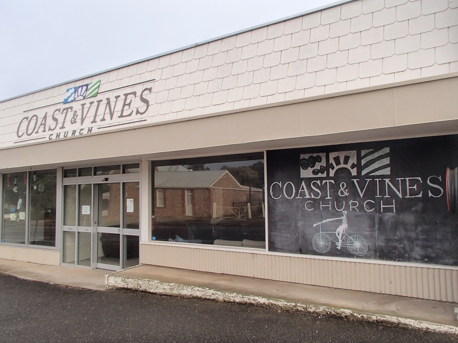
A fine bacon and eggs breakfast and good WiFi delayed progress so it was relatively late morning by the time I got onto the main road heading south. As well as a few well appointed cafes, Willunga has a church apparently dedicated to the trail
The Coast and Vines Church caters to the spiritual needs of cyclists completing the trail
Cafe bacon and eggs catering for cyclists' less spiritual needs, Willunga
Although bearing the title of "Main South Road", the B23 had good shoulders and light traffic, climbing up to skirt the Myponga reservoir before dropping down through the country town of Yankalilla, hitting the coast for a while, then climbing up to Delamere with a view of the Starfish Hill windfarm, and a sunset run down to Cape Jervis and the waiting ferry to Penneshaw.
Myponga Reservoir

Starfish Hill Windfarm at sunset
Folding the Tern and putting it in the baggage van saved me buying a bike ticket. Being mid-week and off season everyone on the boat seemed to know everyone else, and were comparing notes on their trip up to the big smoke of Adelaide.

In Penneshaw a short climb up the hill lead to a heat pump warmed room at Kangaroo Island Backpackers, and a stroll along the main drag to the Penneshaw pub for bangers and mash.

Unfortunately time was running out, and I realised that exploring Kangaroo Island by bike needed at least a week rather than the day I had left; so I settled for a ride along the shore past a curious Greek temple like structure sheltering  a reproduction of a rock carved by French explorers in 1803.
Shelter for rock carved by French explorers, Penneshaw bay
When the road curved inland I parked the bike and headed up Ironstone Hill, site of a farm belonging to an early settler, Harry Bates. Before the arrival  of threshing machinery, Harry processed his grain on a circular threshing platform, now looking like a druidic circle on the summit of the hill.
Threshing circle, Ironstone Hill
Kangaroo Island is relatively pest free, and a haven for wildlife. Out to sea, a couple of dolphin worked their way down the coast, and in the scrub, shy wallabies peered out nervously as I passed. Despite the island's name, I failed to see any kangaroos.
Wallaby, Ironstone Hill track
Next morning I was back on the ferry, and the connecting bus to Adelaide, covering a couple of days cycle touring in a few hours. The Peninsula had turned out to be a satisfying cycle touring area - a good rail trail south from Adelaide, relatively quiet roads in the south, and lots of potential if I manage to make it back to Kangaroo Island - who knows, I might even see a Kangaroo!